BVEStation

Show Posts

This section allows you to view all posts made by this member. Note that you can only see posts made in areas you currently have access to.


Topics - JayJay85

Pages: [1] 2
1
NYCTA Projects / (WIP) Official Update Thread for the NYCTA IND Routes
« on: August 23, 2014, 12:48:29 pm »
I just want to make announcement that the A line from 207th St to Rockaway Blvd is being updated with newer textures from 2012-2014.

The (A) from 207 St to Far Rockaway, Queens and from 207 St to B 116 St-Rockaway Park, Queens.
This will be a (A) 8th Ave Express, Fulton St Express.

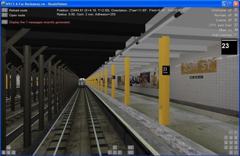
Here's updates.

23rd Street.

2
This Route has been released!
Link: http://www.bvestation.com/downloadinfo.php?id=90


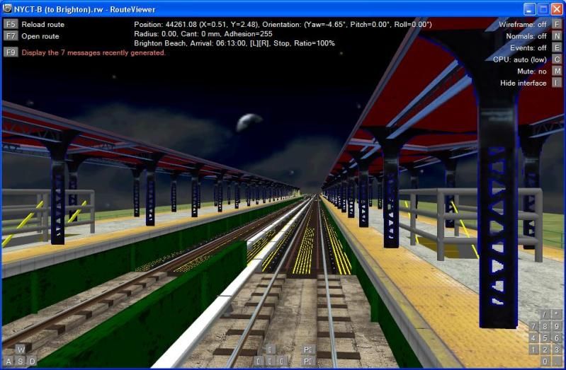
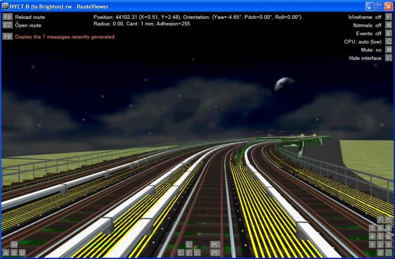
The Southbound B Train is back in development as of october 2012

here is a picture of Brighton Beach


curve right before Brighton Beach

3
Other Projects / BMT North Shore Line
« on: September 10, 2012, 05:32:58 am »
BMT North Shore Line is a route that is connected to the BMT Tottenville Line and built over the SIR North Shore right of way surface simular to the BMT culver ;ine as a el. BMT North Shore Line was built 1919 but didnt finished in Aug 1, 1928.
The route runs from ST George to Port Ivory.

5
NYCTA Projects / More IND Second System routes
« on: December 11, 2011, 11:54:25 pm »
I am announcing that more IND Second Systems routes are development.

Astoria Line Extension: This would have curved east along Ditmars Blvd., Astoria Blvd., 112th St., and then diagonally across intervening streets and the Flushing River to Nassau Blvd. for several miles to Cross Island Blvd. (Francis Lewis Blvd.) This line would have been entirely elevated, with two tracks to Astoria Blvd., then 4 tracks to Parsons and Nassau Blvds. (Nassau is now the LIE service road), and then 2 tracks to its terminus. Broad areas of Queens including Steinway, East Elmhurst, Kew Garden Hills and Fresh Meadows that are not served by rapid transit today would have had direct subway access.

Liberty Avenue Line: Extension of the A, then under construction. 4 tracks from Eastern Pkwy/Broadway Junction along Liberty Avenue to about Wyona Avenue, and then 3 tracks along the Liberty Avenue el from Grant Avenue to Lefferts Blvd. But, it didn't end there. The Second System would have made great strides in serving parts of Queens not served at all today (see details of Queens lines below). The Liberty Avenue line would have been extended along Liberty Avenue and then Brinckerhoff Avenue and Hollis Avenues all the way to Springfield Blvd., a distance of 6.2 miles. 3 tracks would have been present to 180th St., and 2 tracks from there to Springfield Blvd. There would have been a short 2 track spur running along 180th St. and then Jamaica Avenue to connect to the end of the Jamaica el at 168th St. Presumably, all beyond Lefferts Blvd. would be an el, but that is not specified. This line is sort of what the Archer Avenue line was supposed to be, as there would also have been a transfer to a line tying-in with the Queens Blvd. IND running down Van Wyck Blvd. That line would have also gone (as a separate line) to SE Queens.

Broadway-7th Avenue Extension of 1, from 242nd St, Bronx to Valentine Lane, Westchester County.

6
NYCTA Projects / Official Update Thread For The Southbound K Line
« on: November 10, 2011, 07:55:07 pm »
The southbound K line is in development since this summer it's a rename of H line since the H line runs in the Rockaways.

K will start 55th Street/10th Avenue then curve south on 8th Avenue then run along the A line to Chambers St then curve southwest to Hudson River and passes under Ellis Island then it goes Elevated 1 mile before curve south on Broadway in Bayonne NJ then goes back underground to crosses Kill Van kull River to Staten Island then it goes elevated again on Richmond Terrace and Jewett Av then continues on Jewett Ave and continues Bradley Ave after it crosses Victory Blvd then Bradley Ave becomes Brielle Ave and routes ends at Forest Hill Road in New Springfield, Staten island.

the section south of Bowling Green to Forest Hill Road will be 3 tracks.

7
NYCTA Projects / (WIP) Official Update Thread For The Northbound N Line
« on: September 04, 2011, 10:26:25 pm »
I am making announcment that northbound N line is in development by ARome and BVEstation Staff (inculding BStyles).
Also i am making N skeleton so can send it to the ARome and Bvestation Staff so they can detail the stations.

here is the first pic of the route

8
NYCTA Projects / (WIP) NYCT-A Line Update Thread (Rockaways)
« on: August 08, 2011, 10:48:02 pm »
This is the update thread for the (A) Line, which is currently under development by the BVEStation Staff. This thread will give you an idea of the progress, updates and information concerning the (A) Line. All 3 versions of the (A) line are being constructed and/or redeveloped.

The (A) line operates all times between Inwood-207 St, Manhattan and either Lefferts Blvd, Rockaway Park or Far Rockaway. During Rush Hours, trains operate to/from Rockaway Park. During Late Nights, (A) trains only go to Far Rockaway with a Shuttle train from Euclid Av to Lefferts Blvd.

The primary trainset for the (A) is R46. However, when the (A) is completed, it will use both R46 and R160 trainsets.

The (A) line will be made from top to bottom. Do not ask when it will be completed nor anything off topic as the post will be deleted immediately.

9
Should the Staten Island's North Shore Line and Hylan Line be part of IND or BMT since i made a connection to/from the BMT 4th Avenue Line and IND Culver Line
it's up to you guys to vote

10
I am announcing all of Staten Island Subway lines are being reworked on and revised

This line will be base on History these routes was originally proposed in 1922 but never built (actually the sections of the tunnel was built)

The Southfeild Avenue Line
4 layup tracks will start from fith Avenue and 67th Street, Brooklyn as a subway
thence along 67th Street to fouth Avenue to marge with 2 other tracks connection
at 3rd Avenue from Fourth Avenue subway at 61 street to 67th street thence to be
continued on 67th street then under Narrows to Bay street Staten Island, and
thence through bay street to nixon street, thence to be continued as a two
three-track elevated line through Bay Street, Southfield Avenue to Reynolds
street, thence through private property for about 2500ft to Clove Road, thence
through new road being built called Louisiana Road to Old Town Road, back to
thence through Southfield Avenue to
Barclay Avenue, thence through private property (that farmland park soon be
extension of Southfield Avenue and new road named Tiffany Road) to Amboy Road
thence through Amboy Road to end of Staten Island in tottenville then back as a
subway under Arthor Kill to Perth Amboy, New Jersey.
It was decided it won’t take over SIR Tottenville Railway from B & O instead IND Tottenville-Perth Amboy line will parallel SIR Tottenville line due to Governor Al Smith wanted to keep SIR Tottenville for freight service.
[Notice Southfeild Avenue was renamed Hylan Blvd.]

SIR North Shore Line
It would have Branches off at ST George then curve North on ST Mark Place to Westervelt Avenue as a 3 track subway line, then would have emerged to follow the SIR North Shore ROW to Port Ivory, then to Elizabeth NJ, 2 tracks to Elizabeth New Jersey. But only 2 stations was built to New Brighton-Jersey St and also it was built as a 2 track line instead of 3 tracks.

History (fictional)
Under this 1913 Dual Contract Proposal the City and BMT wanted to expended
Dual Contracts to Staten Island but in early 1920's Mayor John F. Hylan tried to
block the construction from going through or from being completed even through
construction has started in two places, one in Dec 1917 at Huguenot Av on Amboy
Road (that was before he came in office) and other place in June 1922 at 67th
Street near 1st Ave, due to also he made sure that any other remaining portions
of the Dual Contracts that were still not built at the time would not get built
during his tenure at City Hall. There was no way that he would spend City money
for the private traction interests. But the NY Governor Al Smith and his state
legislators took BMT side when it comes to building a subway line in Staten
Island because they felt that Richmond County (Staten Island) need a subway line
really bad. So in 1924 a compromise was reached between BMT, City hall and NY
state legislators regarding to continue construction building subway/elevated
line in Staten Island. Then City hall and NY state legislators made BMT change
the length of the station platforms to 600ft from 530ft before construction can
be completed at any station in Staten Island by BMT agreeing to it that made it
easier for IND to take over, that was the plan behind the scenes. In 1927 when
BMT got into financial problems so they abandoned construction, then around July
1927 IND took over to finish the construction. Stations between Bay Terrace to
Perth Amboy and New York Harbor/Narrows Tunnel was constructed by BMT awhile IND
took over the rest of the stations

IND Victory boulevard
Under this 1929 IND second system proposal this line would branch off the Tottenville Line at the south end Tompkinsville station thrn curve west under Grant Street then under private property and merge as a elevated at Ward Avenue then curve south-west above Victory Blvd at Austin Place, then continues above Victory Blvd to end of Staten Island in Chelsea, then goes back underground to cross Arthur Kill River to Carteret New Jersey the line ends at Roosevelt Avenue and Beverly Street. This line was completed on June 1, 1937. Originally 85% of the route supposed to be underground (from Tompkinsville to Harvey Avenue)  then it was change to 85% of the being elevated due to being 4 times cheaper to build elevated structure as oppose to building a subway. Total cost to build this route was $32,500,000

11
NYCTA Projects / Official Update Thread NYC subway car R179
« on: April 05, 2011, 05:00:25 pm »
I am making announcement that the R179 subway has been development for awhile
by me, with the help from Error, (SIR) North Shore Line and Bstyles

any Questions feel free to ask in this thread

12
NYCTA Projects / Status of Routes as of November 2016
« on: April 02, 2011, 12:26:05 pm »
Status of route development as of November 5th, 2016.

BMT/IND:
(A): Rockaways-bound version currently under development by the staff of OpenBVE Connection. On hold to allow development of other projects. No definite release date.

(B): Coney Island bound currently under re-development by Mr Railfan and Dj Hammers. Will be released concurrent with the updated (Q).

(C): Brooklyn Bound version was under re-development by Blue18. Route is on Hold.

(D): Currently a version truncated to Bay 50th Street has been released by JayJay85. Section between Bay 50th Street and Coney Island now roughed out as of August 2014 and will be completed by Mr Railfan and Dj Hammers, will be released concurrent with the updated (Q).

(E): Currently under development by Emari, having taken over from TrainFanInfinity.

(F): Comprehensive F line package with scenarios was released by Mr Railfan several months ago. An updated version with more detail will be worked on in the future.

(G): Southbound version has been released by ipac. Version to Church Avenue will be developed in the future. Northbound version is under development by TrainFanInfinity

(J)/(Z): BETA has been released on OpenBVE Connection. Full detail version currently under development by JayJay85, Mr Railfan, and Dj Hammers. Will be finished after the completion of the full (Q), (D), (B), (N), and southbound (R) lines.

(L): Re-done version of the line 8th Avenue-14 Street bound was under development, but is halted at this time. Will be worked on in the future.

(M): Was under development by Phantom909, now by Mr Railfan and Dj Hammers. Section between Metropolitan Avenue and Myrtle Avenue is now 60% finished - major detailing work remains. The Chrystie Street Connection will be created and the line will be connected to the northbound (V), which will have detail added. Will probably be released after the updated (J)/(Z).

(N):Southbound 75% finished by JayJay85 by March 2014. Remainder of work is being finished by Mr Railfan and Dj Hammers, will be released concurrent with the updated (Q). Northbound under development by ARome, currently halted to focus on development of the the southbound (R).
 
(Q): Coney Island Bound currently under development by Mr Railfan and Dj Hammers. Development is ongoing but delayed due to school and work. Both a 2006 version and a 2016 version is under development. Will include multiple scenarios such as reroutes and short turns. Will be released along with the full (D), (B), (N), and southbound (R) lines. A WIP version of the route can be tried at the Transit Museum on weekends.

(R): Brooklyn bound version was actively being developed by ARome, and will be released with the (Q), (D), and (B) lines. Forest Hills bound was under development by ipac, now under development by ARome as well. Northbound is on hold to focus on the southbound routes.

(W): Southbound version will be updated following the release of the (Q), (D), (B), and southbound (R) lines. Northbound version is not under development at this time, but may be worked on following the release of the northbound (R).

IRT:
(1): Currently under development by the staff of OpenBVE Connection. Undergoing heavy detailing work.

(2): Flatbush Avenue-Chambers Street under development by BStyles concurrent with the (3), (4), and (5). Chambers Street-Wakefield currently under development by the staff of OpenBVE Connection. Undergoing detailing work.

(3): Under development by BStyles concurrent with the (2), (4), and (5).

(4): Under development by BStyles concurrent with the (2), (3), and (5). and has full detailing at some stations. all elevated switches and curves are done.

(5): Under development by BStyles concurrent with the (2), (3), and (4).

(6):  BETA version of Manhattan Bound to Brooklyn Bridge NB released. Version that includes the full run back up to Pelham Bay Park and full detailwill be worked on in the future.

(7): Manhattan bound was under development by EDawg for a very long time, recently was heavily updated but is on hold at the moment. Taken over by Ztraintobroad

Enjoy for now!
13
This route has been completed. The download link is in the downloads section!


Hello guys i wanted to let u guys known to that D extension is in development on 2nd half is in development and 1st half from 205th St to Grand St will also be updated (just modifying texture, roofs and tunnels).

14
NYCTA Projects / (WIP) Official Update Thread for the NYCTA BMT Routes
« on: February 23, 2011, 09:38:02 pm »
Download the J/Z line Public BETA here:
LINK
Note that the route is not finished. Further development is being done on the route.


Here is the official Thread of NYCTA BMT Routes. This includes the J, M, Z, Q, B, R, D, and N lines.


The J and Z lines have been development for 5 years (2 years by some guy that knows joe and 3 by me)
This line could've been finished but i was busy with F line and Joe was busy as well with other things

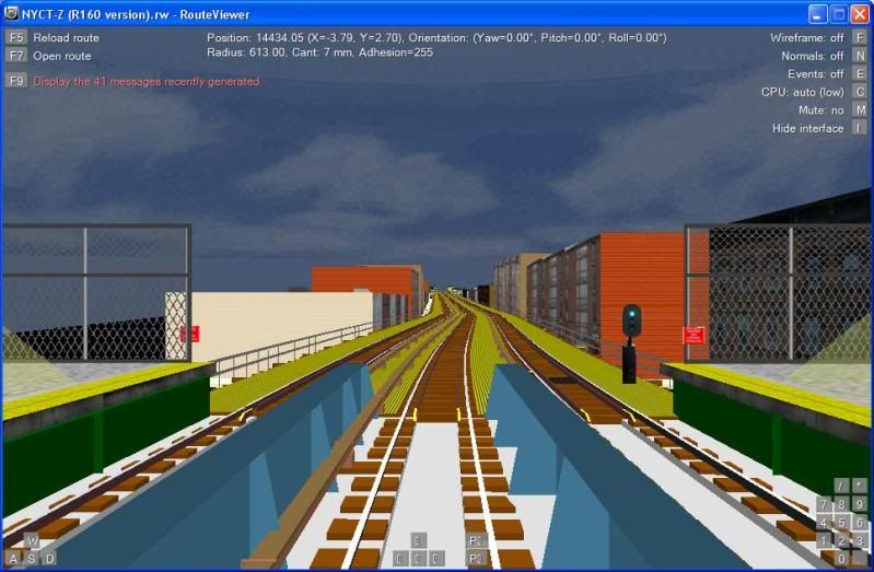
Here are some pictures of the J/Z line so far:

Flushing Av

Woodhaven Blvd

15
NYCTA Projects / Official Thread for the BMT Culver Shuttle
« on: February 21, 2011, 10:20:36 pm »
Hey guys I got the BMT Culver shuttle in development this is one of my secret routes i didn't talk about
i would need make sure the distance is right i would to talk to Joe.

here some pics

9th Avenue Lower Level

Fort Hamilton Pkwy

Pages: [1] 2